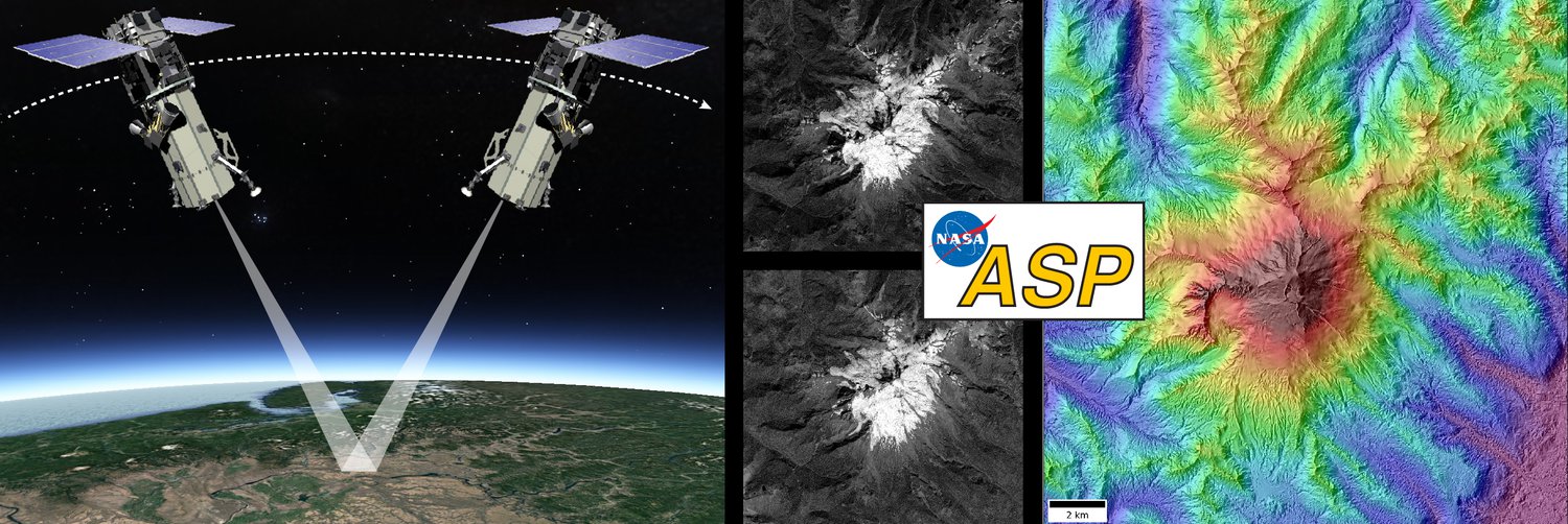
We have developed automated processing workflows to generate high-resolution digital elevation models (DEMs) and radiometrically corrected orthoimages from sub-meter resolution commercial satellite images. These workflows are deployed in high-performance computing (HPC) environments for mass production and data analysis. The resulting products can be used for many applications, including change detection, volume change analysis, and feature tracking.
The core of the workflow uses the NASA Ames Stereo Pipeline.
See Shean et al. (2016) ISPRS for more details.
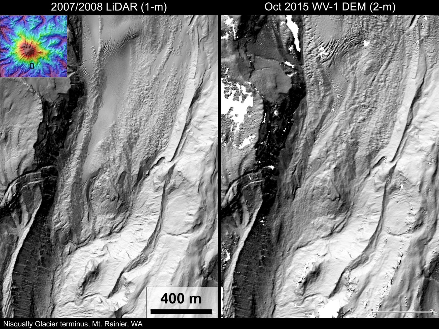
Comparison of airborne lidar and WorldView stereo DEM for the Nisqually Glacier terminus
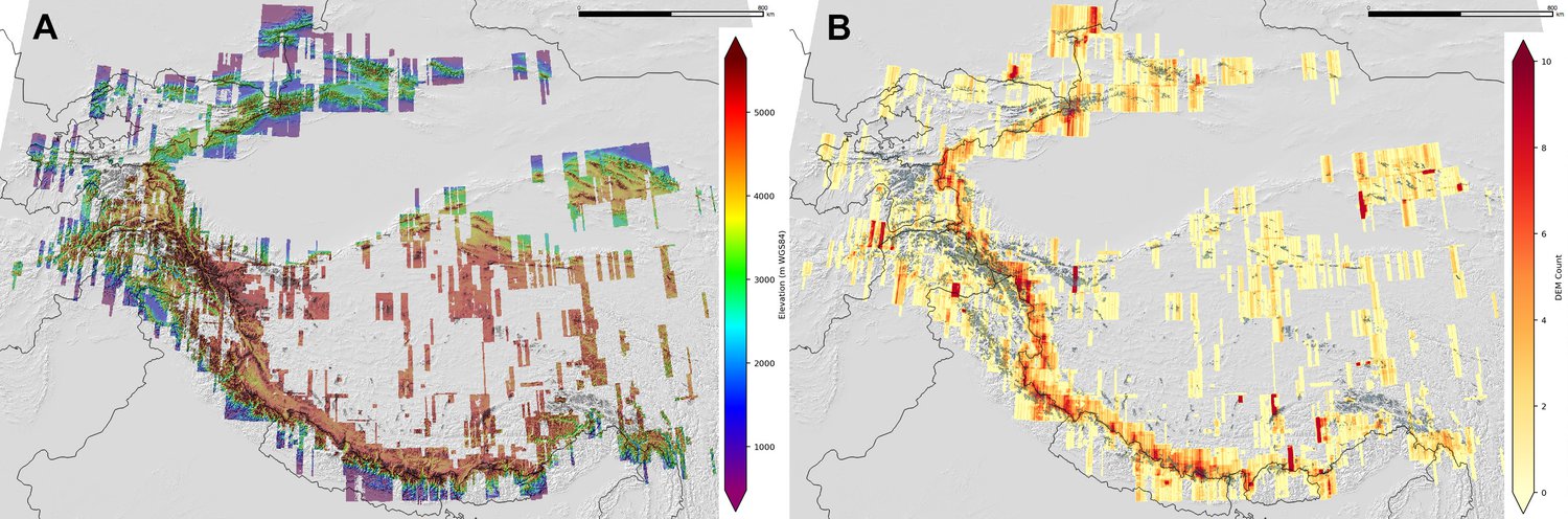
Mosaic and count map for over 4000 DEMs in High-mountain Asia
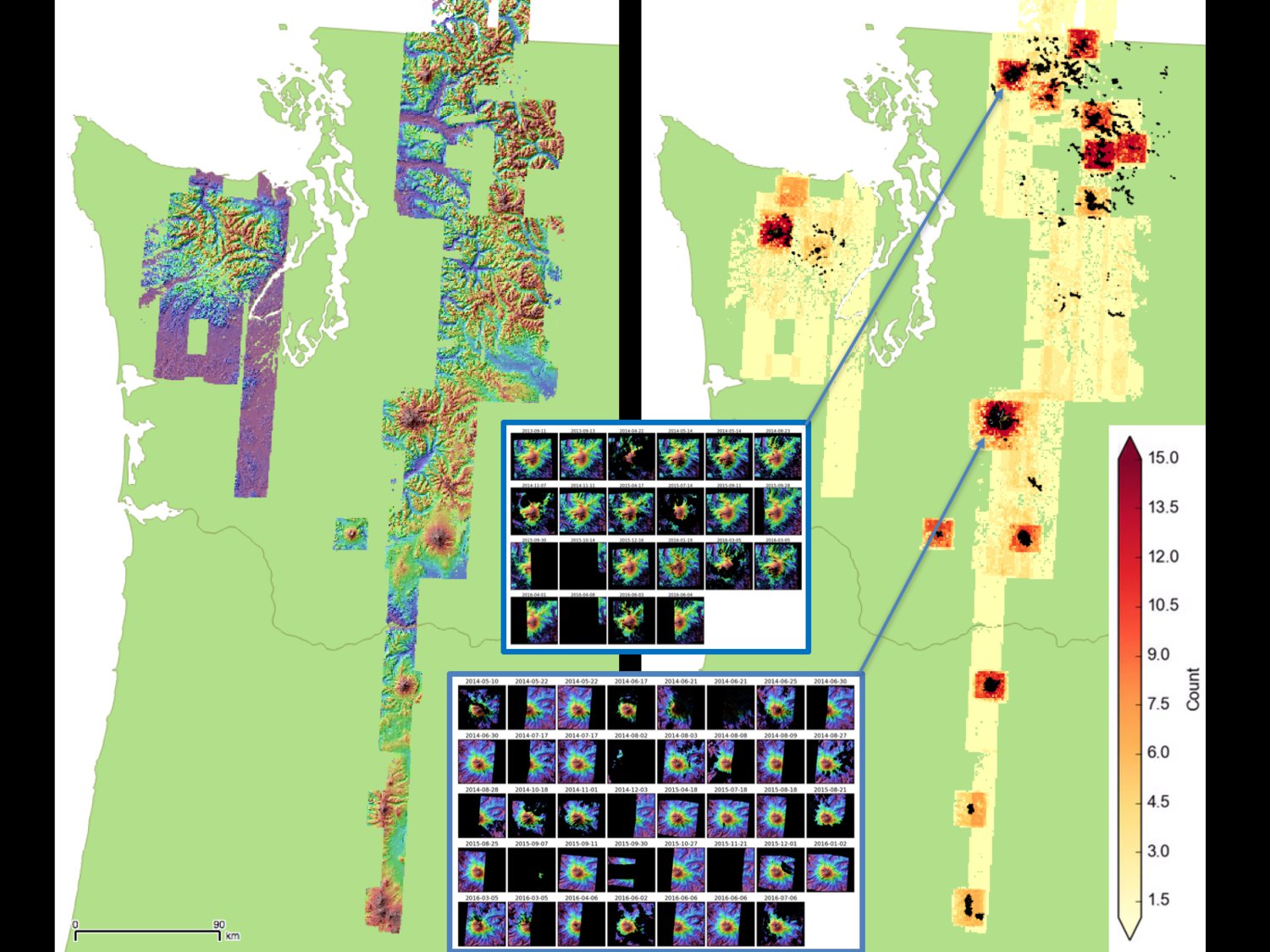
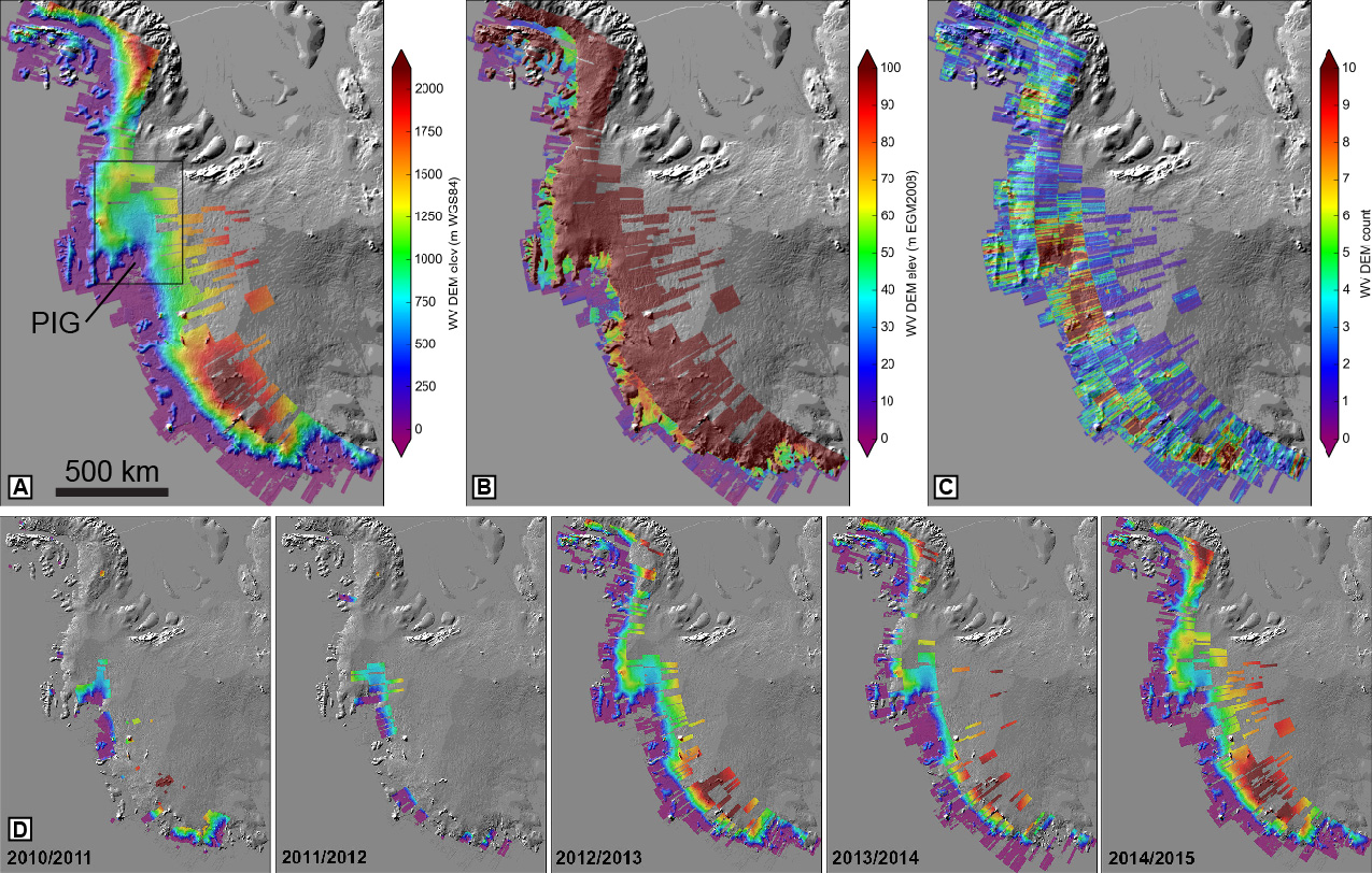
Mosaic, count map, and time series insets for DEMs over glaciers in the Pacific Northwest