Using repeat, high-resolution DEMs to capture the spatiotemporal evolution of snow depth and snow water equivalent (SWE) on a regional scale.
Motivating questions:
- How much snow falls in the Western U.S. each winter?
- Are downscaled reanalysis products capturing true spatiotemporal evolution of snow?
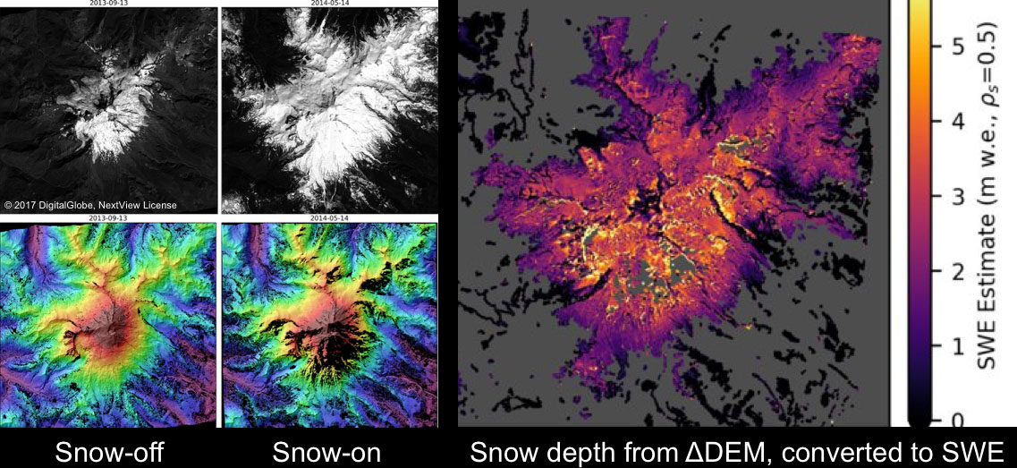
DEM-derived snow depth for Mount Baker, WA
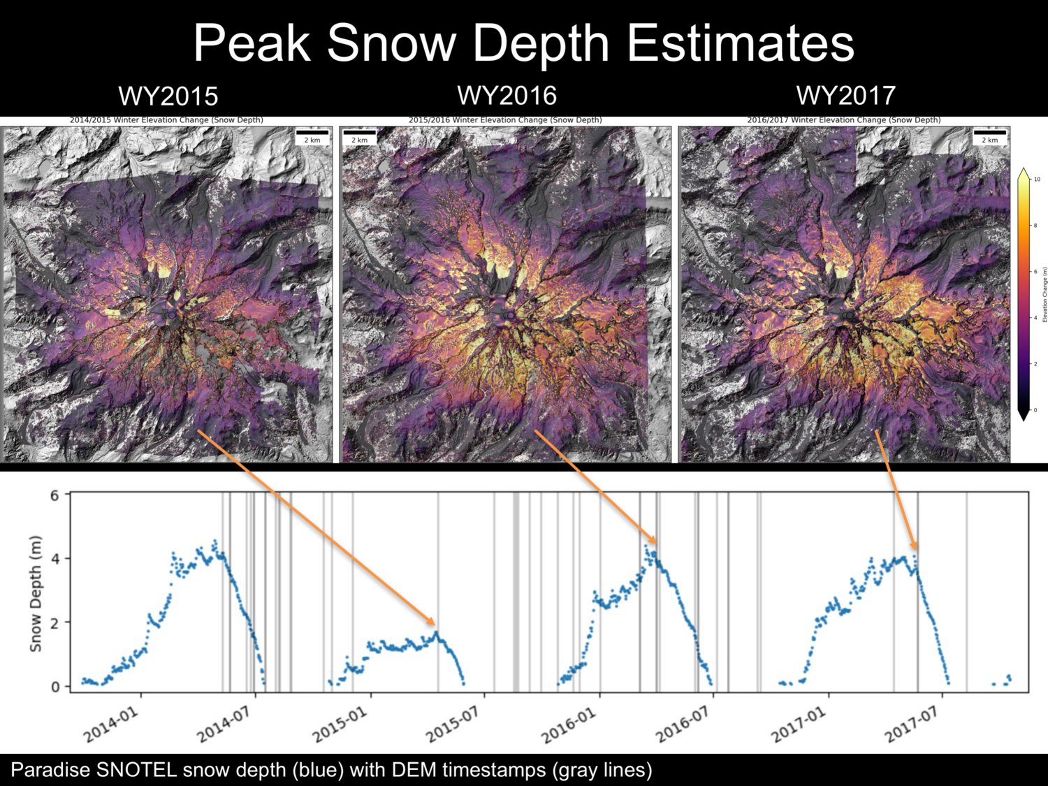
Time series of snow depth for Mount Rainier, WA. Timing of spring stereo image collection allows for peak SWE estimates.
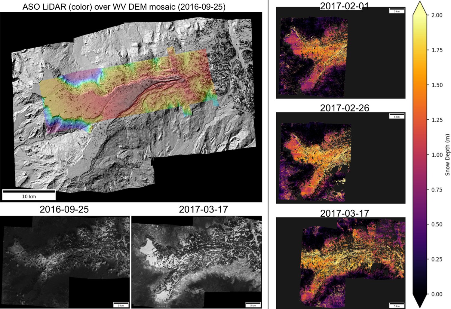
Preliminary time series of snow depth for Grand Mesa, CO during NASA SnowEx 2017 campaign.