Multi-view stereo photogrammetry offering high-resolution 3D models and orthomosaics.
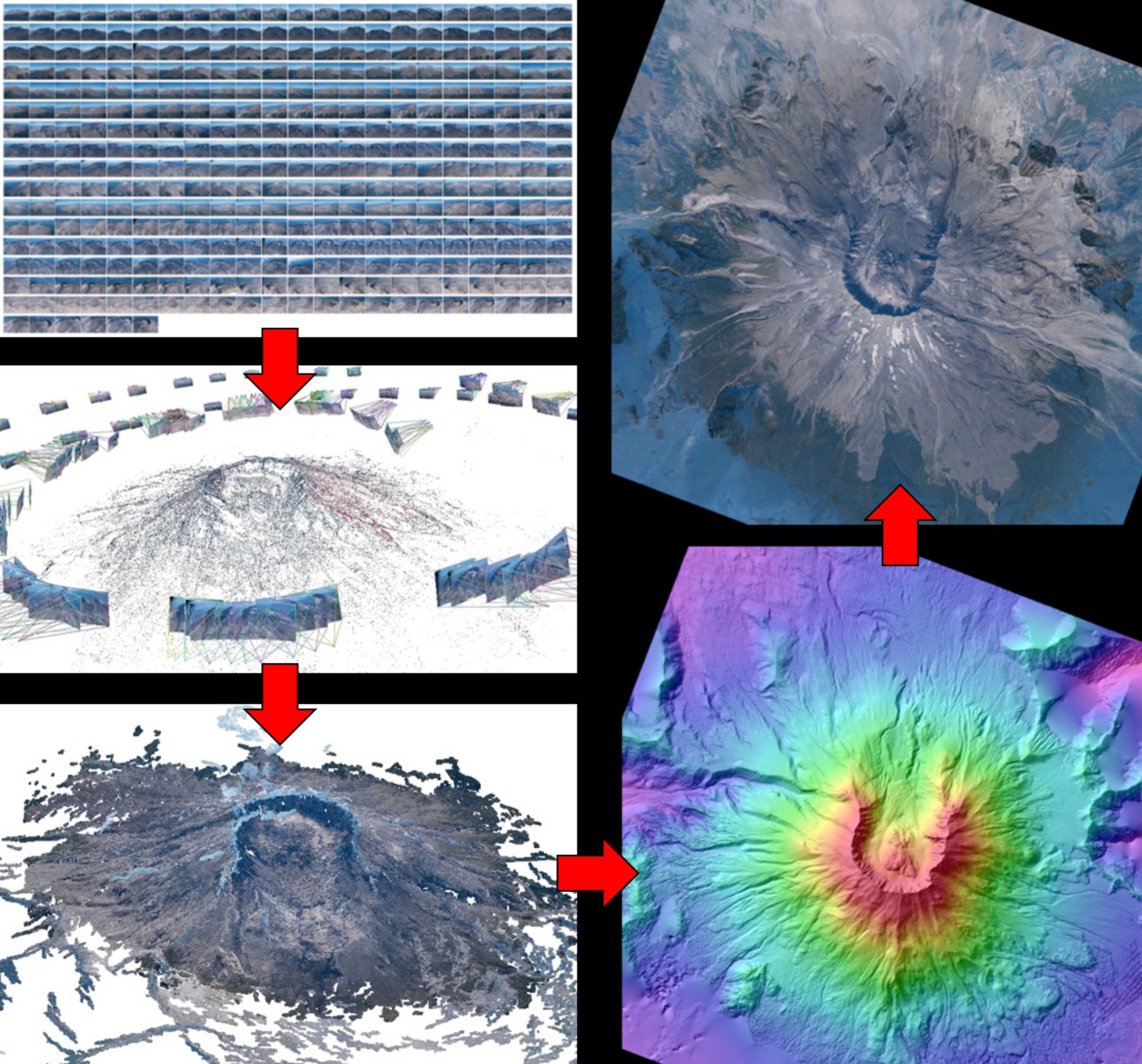
We’ve been experimenting with this powerful technique since 2012, peforming surveys using:
- Unmanned Aerial Vehicles (UAVs, AKA drones)
- Manned aircraft for oblique and vertical aerial surveys (fixed wing, helicopter)
- Close-range photogrammmetry (tripod)
At the UW, we use the following multi-view stereo and SfM software:
- Pix4D
- Agisoft PhotoScan Pro
- VisualSfM
- NASA Ames Stereo Pipeline
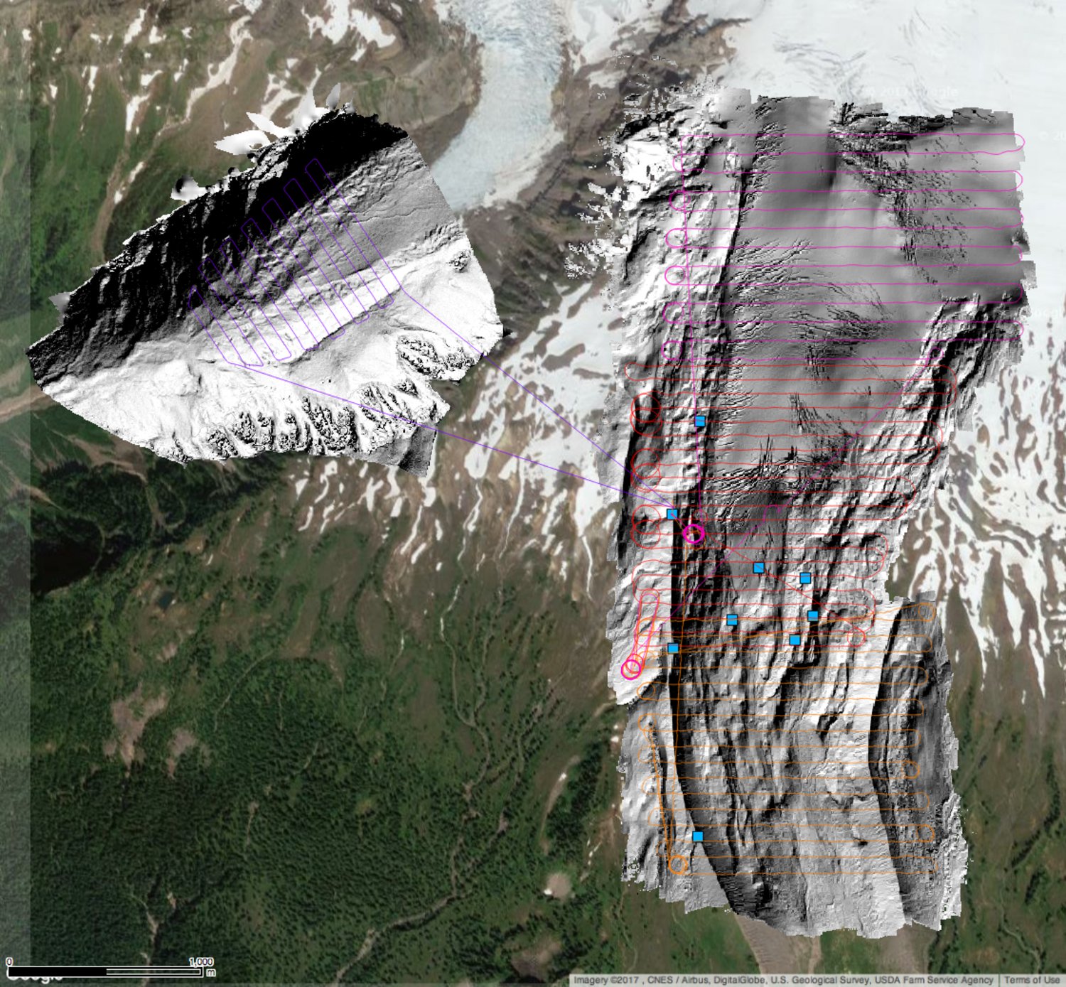
Flightlines and shaded relief maps from October 2017 autonomous UAV SfM surveys of the Easton Glacier, Mt. Baker. Image ground sample distance (GSD) was ~4 cm, with total areal coverage of nearly 5 km^2.
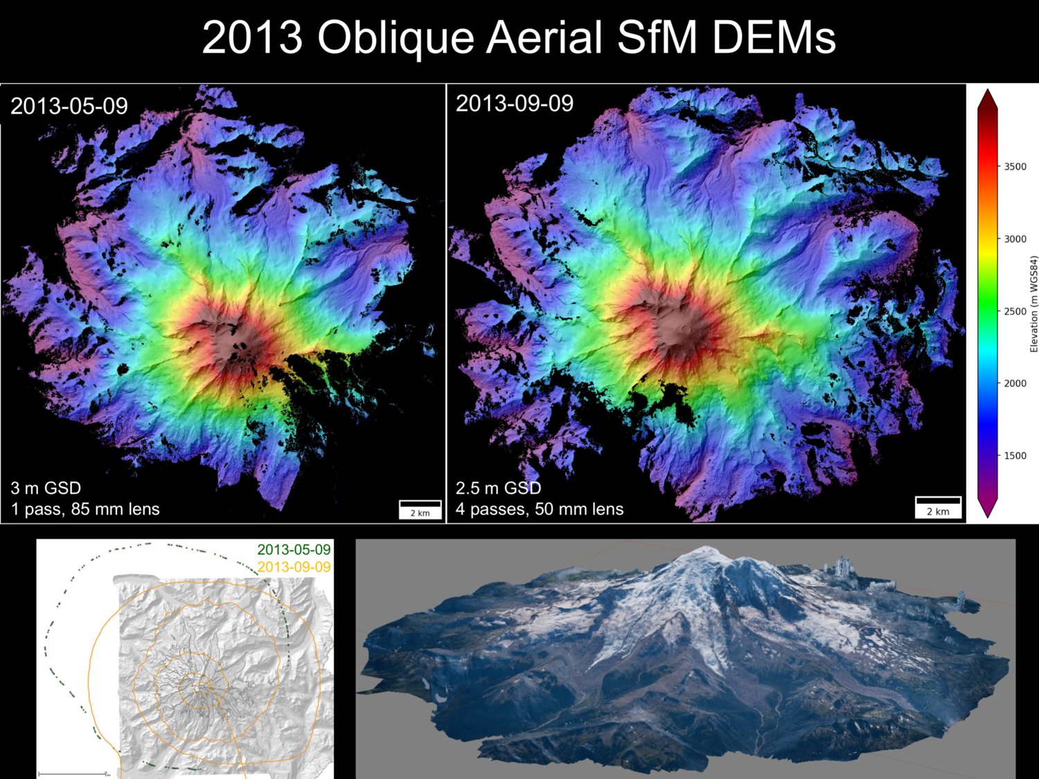
Early experiments with oblique aerial SfM surveys of Mt. Rainier, collected with Nikon D800 DSLR and Trimble GeoXH GPS
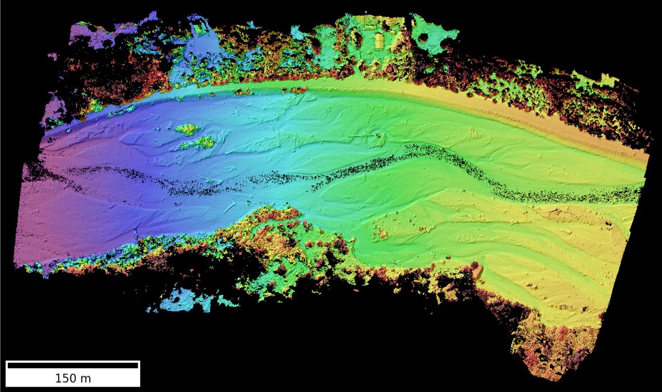
July 2017 DEM from autonomous UAV SfM survey of the Nisqually River outside of Mount Rainier National Park