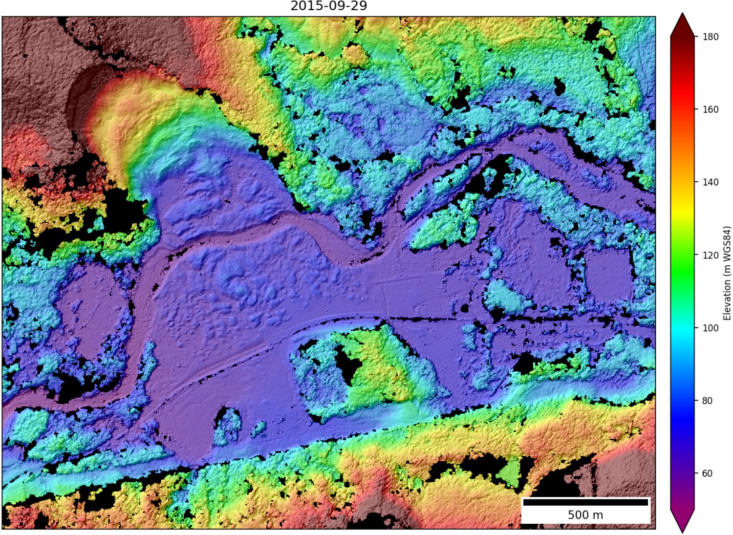
WorldView DEM mosaic of Oso landslide on Sept. 29, 2015
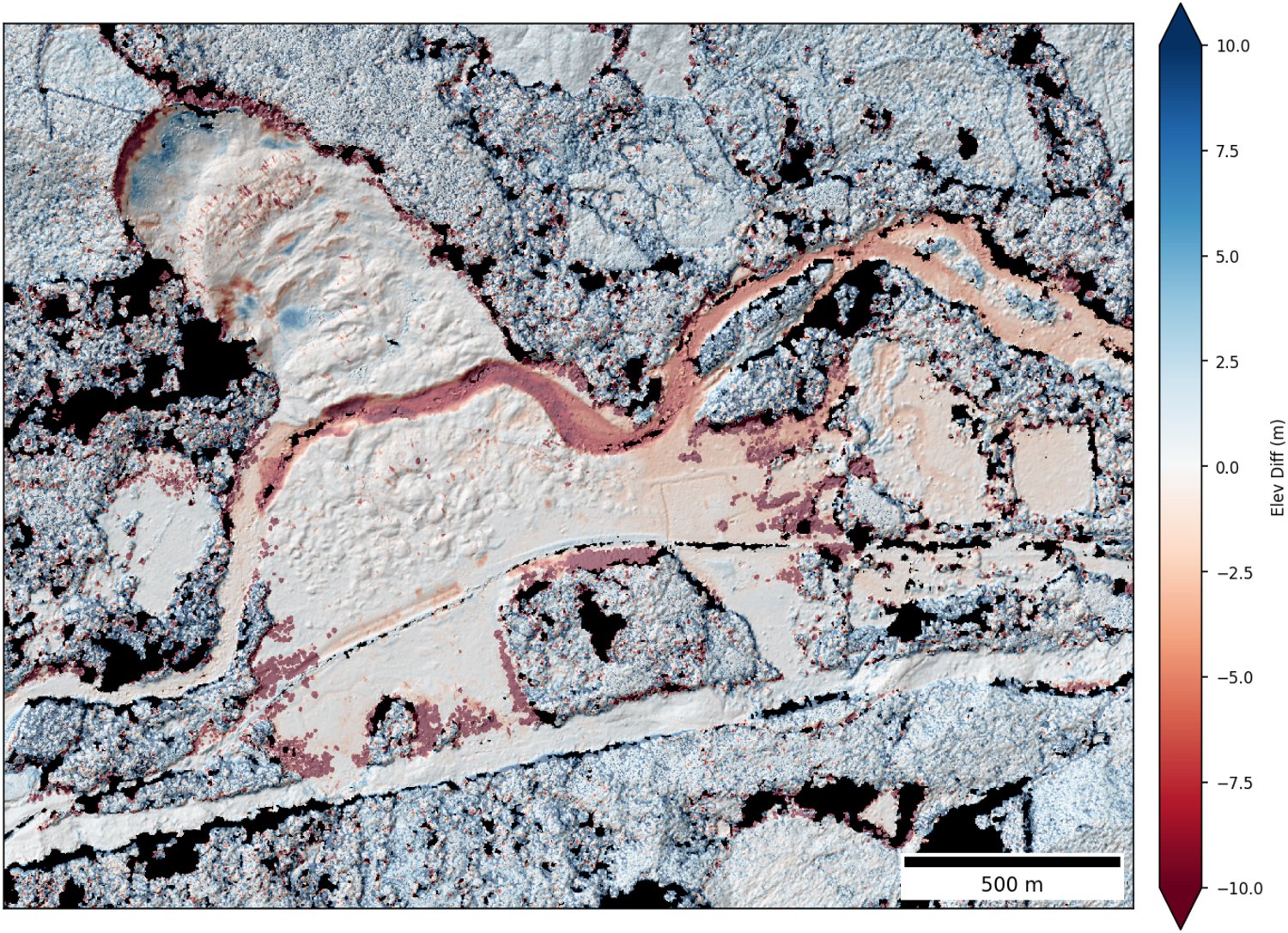
Elevation change over 1.5 years, compared to airborne LiDAR collected on March 24, 2014 (~2 days after slide). Note slumping near headwall, road construction, tree removal, and incision of river.
Geodetic analysis of natural hazards and landscape dynamics
- Landslides
- Glacier Outburst floods
- Coastal erosion
Post-disaster Rapid Response
Collaboration with NHERI RAPID facility at UW
The NSF-supported NHERI RAPID facility at UW will: “enable natural hazard researchers to conduct next generation quick response research through reliable acquisition and community sharing of high-quality, post-disaster data sets that will enable characterization of civil infrastructure performance under natural hazard loads, evaluation of the effectiveness of current and previous design methodologies, understanding of socio-economic dynamics, calibration of computational models used to predict civil infrastructure component and system response to natural hazards, and development of solutions for resilient communities”
We will work closely with RAPID to support and complement future response efforts. We anticipate providing a critical satellite remote sensing component to the existing capabiltiies.
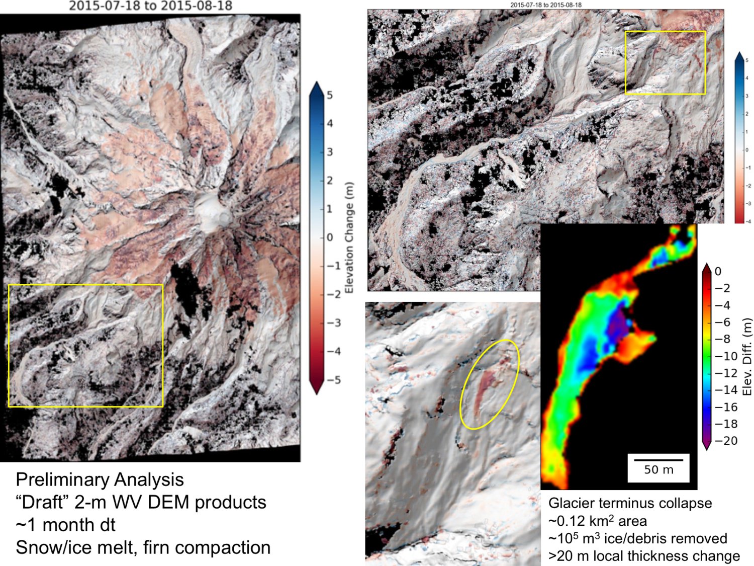
Case study: 2015 South Tahoma Glacier outburst flood
- August 13, 2015
- See Scott Beason’s slides for background and details of event
- DigitalGlobe stereo imagery acquired <24 hours after tasking submission
- Data processing of before and after DEMS, delivery of preliminary analysis within ~3 hours of receipt