An Automated, Open Source Pipeline for Mass Production of 2 m/px DEMs from Commercial Stereo Imagery
Abstract
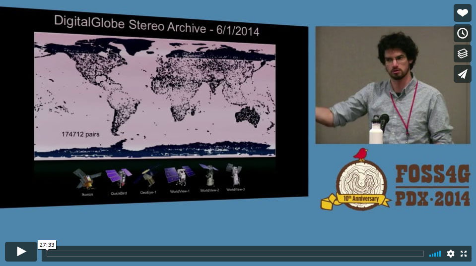
We have adapted the NASA Ames Stereo Pipeline (ASP) - a suite of automated, open source, command-line photogrammetry tools originally developed for NASA planetary missions - to process high-resolution stereo satellite imagery of the Earth. These tools are multithreaded, memory efficient and scalable, which enables processing of big image data (e.g., 16-bit panchromatic WorldView images with dimensions ~36000 x 460000 px). We have deployed this pipeline on the NASA Pleiades supercomputer to generate ~2 m/px digital elevation models (DEMs) and ~0.5 m/px orthoimages for thousands of WorldView-1⁄2 along-track stereopairs. New ASP tools mitigate systematic DEM artifacts and allow for automated, a posteriori DEM coregistration using iterative closest point algorithms. When existing control data are available (e.g. LiDAR, GPS), automated alignment routines offer sub-meter horizontal and vertical DEM accuracy. Our research applications focus on ice sheet dynamics in Greenland/Antarctica and ice/snow evolution in the Pacific Northwest. We have developed an additional collection of tools for DEM analysis, including utilities to produce maps of 3D surface displacement (velocity) vectors and eulerian/lagrangian elevation change. We present the following case studies to highlight the capabilities of these data and our open source workflow: -A 57+ DEM timeseries from 2008-2013 for Greenlands most dynamic outlet glacier, revealing >40 m/yr interannual thinning and large seasonal variability, -Annual DEM mosaics that reveal the ongoing evolution of West Antarcticas weak underbelly, an area roughly the size of New Mexico, -Repeat DEM timeseries for Mt. St. Helens showing volcanic dome growth, glacier advance, canopy height, fluvial erosion/deposition, and landslides. For many applications, DEMs derived from high-resolution satellite imagery are comparable to those derived from airborne LiDAR data, with the advantage of global, on-demand tasking capabilities and reduced costs. Archived commercial stereo imagery is available at no cost to federal employees or federally-funded researchers, and the tools/methods highlighted here offer an automated, open source alternative to traditional, GUI-based, commercial photogrammetry software packages.