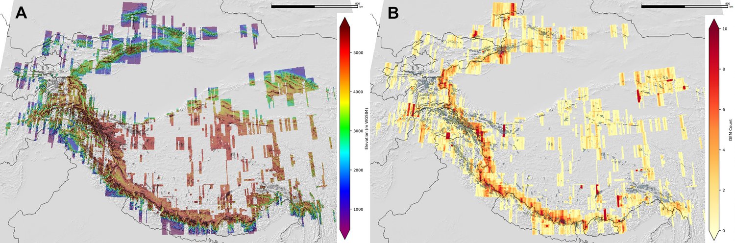
Mosaic and count map for HMA DEM v1 release.
From December 11, 2017 Cryolist post:
NSIDC High-mountain Asia Data Landing Page
Three High Mountain Asia (HMA) 8-meter Digital Elevation Model (DEMs) data sets are now available from the NASA National Snow and Ice Data Center Distributed Active Archive Center (NSIDC DAAC). These DEMs are generated from very-high-resolution imagery from DigitalGlobe Inc. satellites between 28 January 2002 to 24 November 2016 and cover the spatial region from Tien Shan and Hindu Kush to Eastern Himalaya. This region contains one of the highest concentrations of snow and glaciers outside of the polar regions, and the advance or retreat of glaciers in this part of the world provides a window into Earth’s changing climate.
The new High Mountain Asia data sets include:
- High Mountain Asia 8-meter DEM Mosaics Derived from Optical Imagery, Version 1
- High Mountain Asia 8-meter DEMs Derived from Along-track Optical Imagery, Version 1
- High Mountain Asia 8-meter DEMs Derived from Cross-track Optical Imagery, Version 1
To access HMA data and documentation, visit https://nsidc.org/data/highmountainasia.
Data Acknowledgements
- Data author: D. Shean
- Data center: NSIDC DAAC
- Sponsor: NASA EOSDIS